by admin
Share
by admin
Share

Severe weather season shows no sign of letting up early this year. Typically, as we move through June the action starts slowly shifting northward. By July and August, the higher chance for tornadoes shifts to the upper Midwest and northern Plains. But this year that northward shift may be a little slower…much like 2021.
Here is a map showing the highest areas of probability for severe storms in early June.
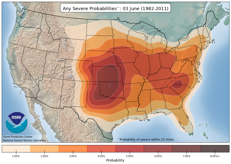
As you can see, climatologically, the action is beginning to shift to the central plains.
June 1st is the beginning of meteorological summer. Although the astronomical start to the summer season isn’t until Tuesday, June 21st this year, June is when the “warm season” really gets rolling for most of the northern hemisphere. As the air warms up higher into the sky, the storm track normally shifts gradually northward.
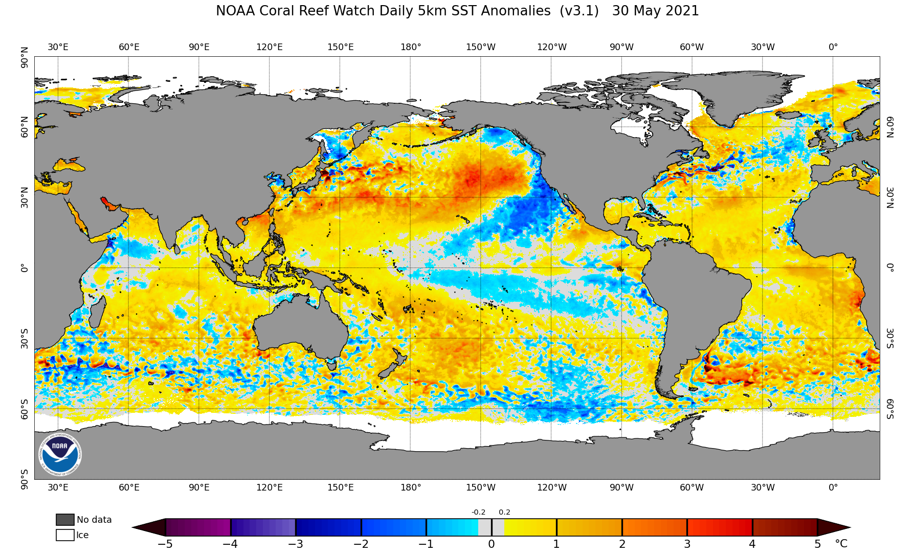
This year, however, there is still a very active upper-level storm pattern over the Pacific Ocean. This is due to the large area of warm water over the northern Pacific. Low pressure areas tend to form over, and track along these areas of warm water. Here is the latest map showing the sea surface temperature anomalies (variation from normal) over the entire world:
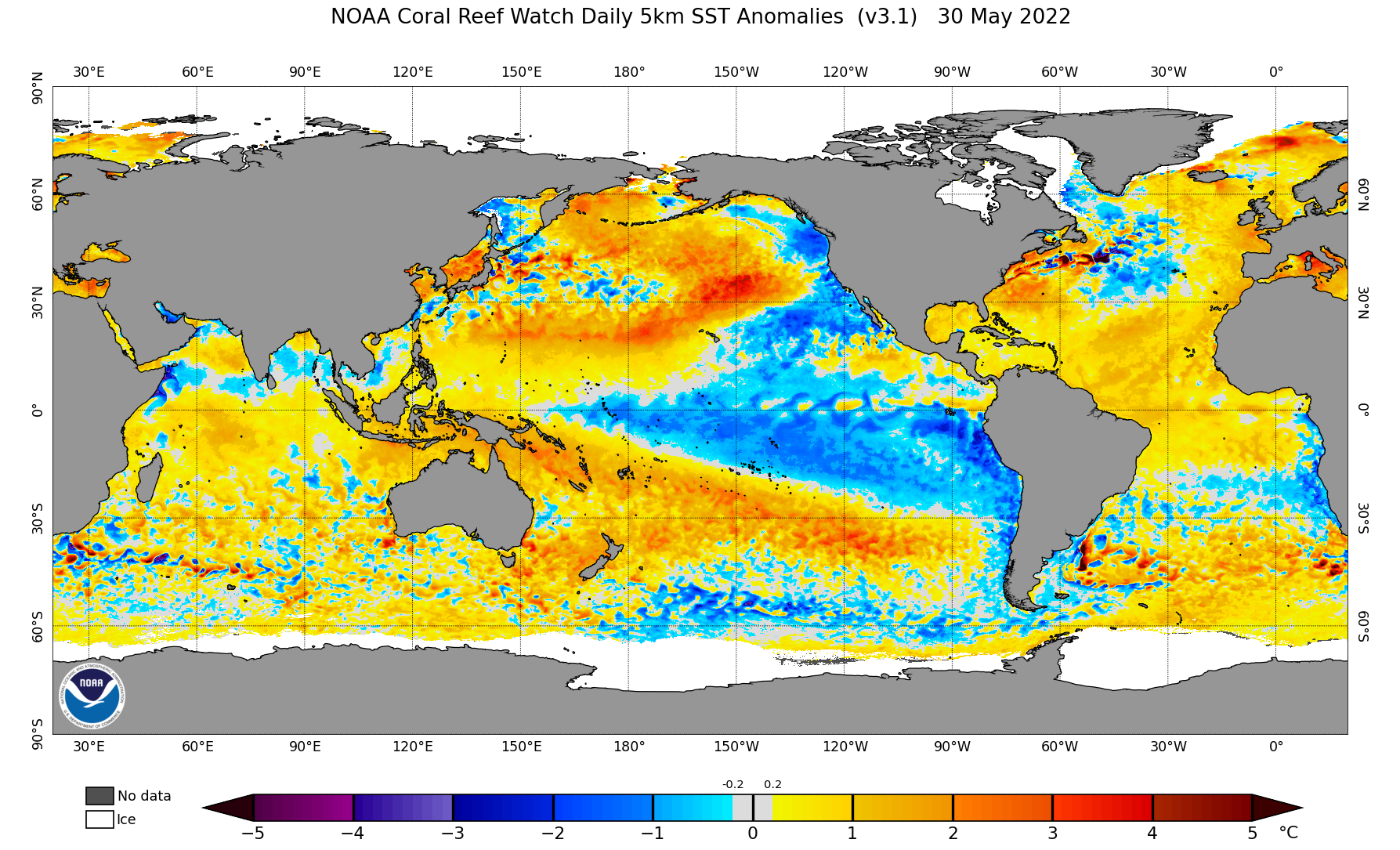
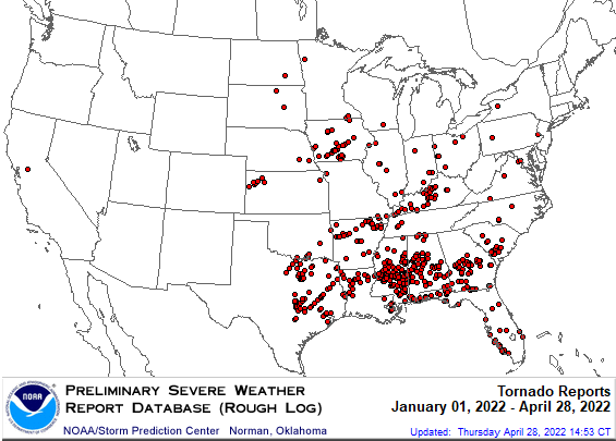
As long as that warm path of water exists, it will keep generating lows that move in off the Pacific and dive down into the plains, then track eastward across the rest of the country. So far, this pattern has produced an active tornado track through the southeast U.S.:
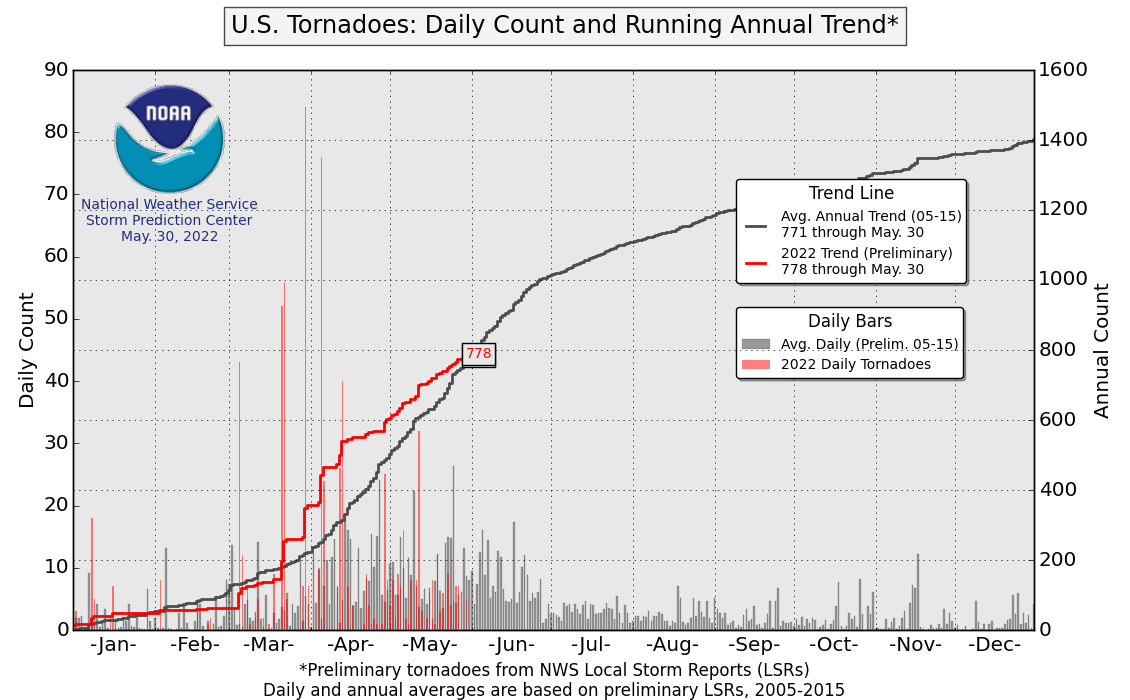
The number of tornado reports in the early spring this year were running above normal, but now the trend is toward a more typical season:
Last year the sea water temperature patterns were similar:
And so were the tornado reports, with the highest total tornado count in the southeast:
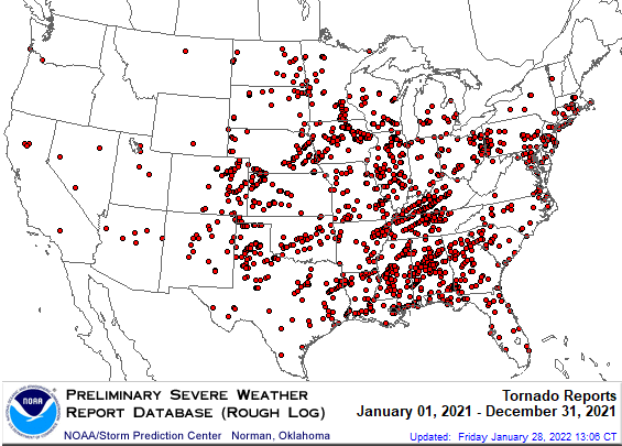
There were a total of 1376 tornadoes reported in 2021. I expect 2022 to be somewhat the same. This is very close to average.
These sea water temperature patterns develop slowly, and change slowly. If you go back to the mid- 1980s, the seas were generally cooler. These are cyclicals pattern that can take decades to shift. Here is what the sea surface temperatures looked like in 1985!
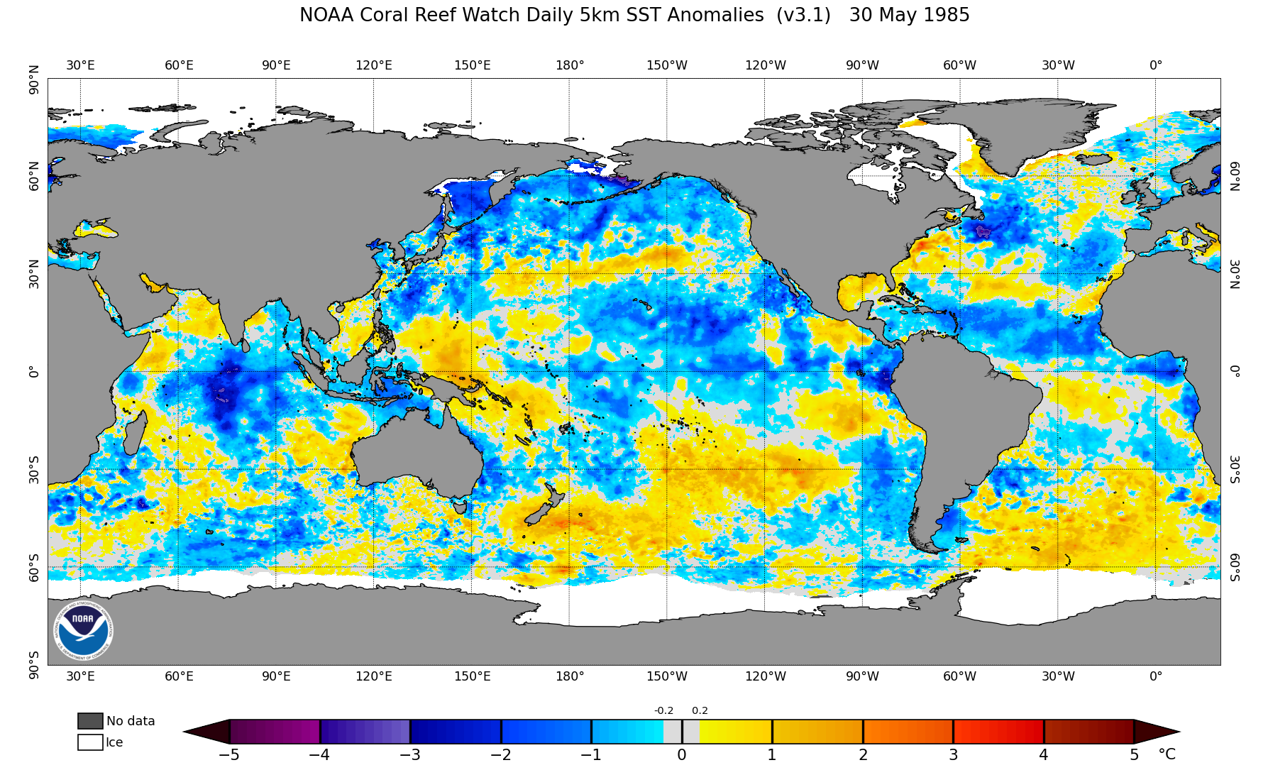
Quite a bit cooler! Nobody knows for certain what causes these patterns to occur and shift, but it may have a lot to do with underwater volcanic activity. Remember 85% of the volcanoes on earth…are under the sea!
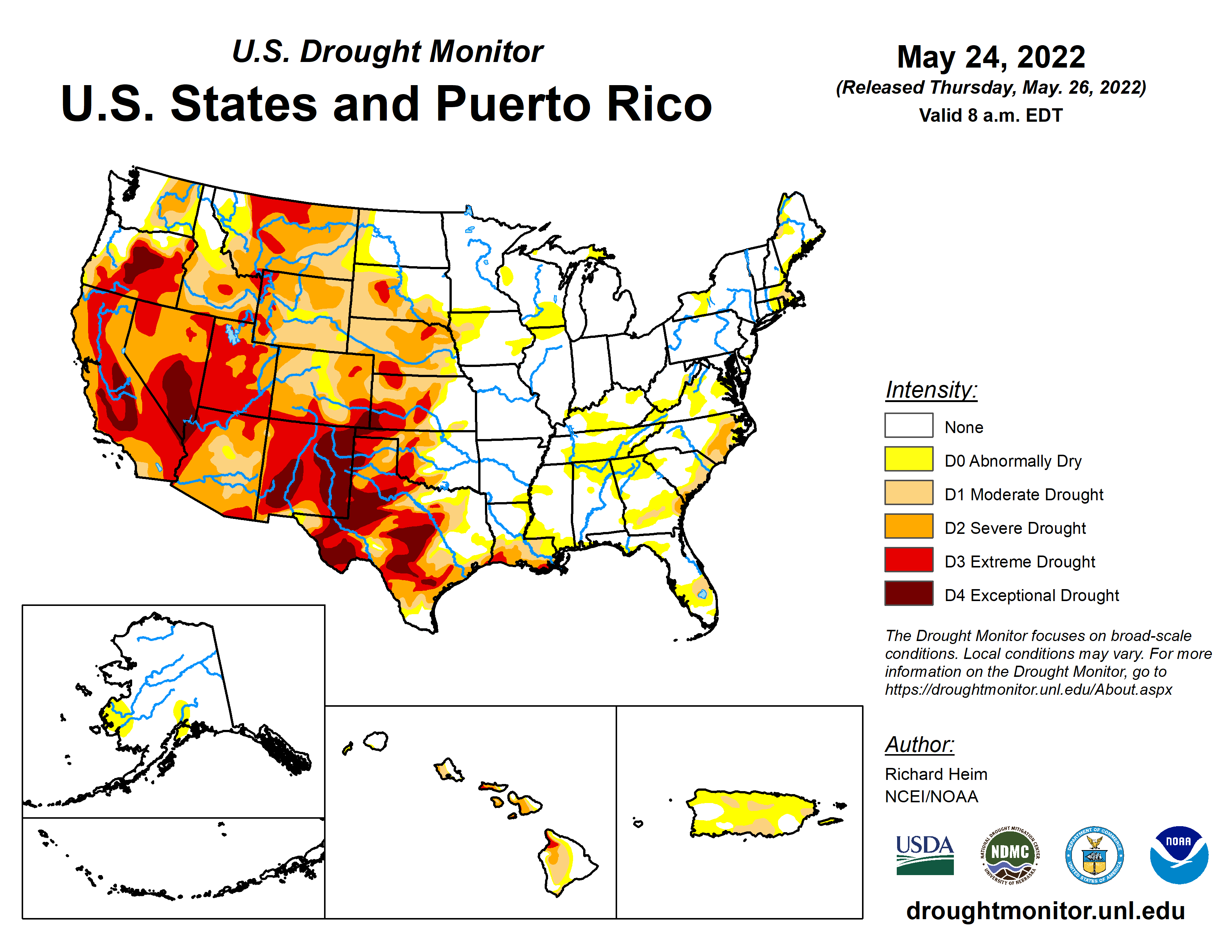
The only big problem with the current pattern is that it forces the storm tracks to go up and over the western United States, so the mega-drought is likely to continue, unfortunately.
Enjoy your summer!
STAY IN THE LOOP
Subscribe to our free newsletter.
October is here, and everyone’s thoughts turn to chillier weather, and what lies ahead for the upcoming winter. As we have said, in previous IQ Weather posts, the location and strength of warm and cold ocean water has a lot to do with the weather patterns currently in play…and the one that will impact winter […]
Summer is in full swing and hot weather is on everyone’s mind. While it may seem like the huge drought and heat wave over the western United States is the worst ever, it is not. There's no doubt it is a big problem, and water levels are critical for many big cities in the southwest. […]
Meteorological winter has arrived! You can always count on IQ Weather to explain the difference! You see, December 1st is the first day of meteorological winter. Typically, that is when you start seeing the colder air starting to push farther south more frequently as the daylight grows shorter. It is also a convenient way for meteorologists […]