by admin
Share
by admin
Share

October is here, and everyone’s thoughts turn to chillier weather, and what lies ahead for the upcoming winter.
As we have said, in previous IQ Weather posts, the location and strength of warm and cold ocean water has a lot to do with the weather patterns currently in play…and the one that will impact winter 2022-23. These ocean water temperature patterns change very, very, slowly, so the dry weather over much of the western half of the United States will continue. And, with the warmer ocean water so far north this year, it’s likely that any big outbreaks of cold Arctic air will not come until late winter. Early season cold outbreaks will be brief and mainly focused over the upper Mississippi Valley, the Ohio Valley, and western New England.
Remember, warm ocean water helps to create low pressure. The current sea water temperature anomaly map looks like this:
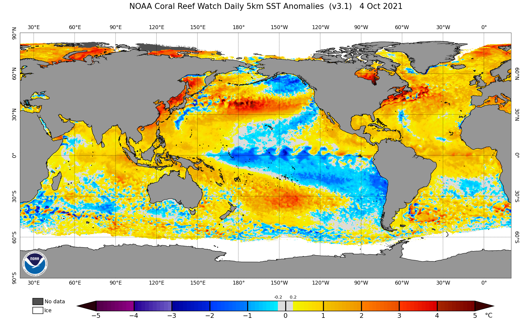
Look at the pattern last year at this time, and notice that the warm water was a bit farther south, and the cold La Nina in the equator regions of the Pacific has grown stronger this year:
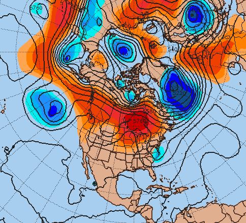
If we look at the middle of the atmosphere, 500 millibars or roughly 18,000 feet above sea level, you’ll notice that the air flow still looks like a summertime pattern, with the closely packed lines of equal pressure farther north. This will bottle up the colder air and prevent it from making any serious push southward for at least another month. And, it keeps the storm systems coming off the Pacific rapidly, so that they don’t have time to pick up a lot of moisture until they reach the eastern half of the U.S. Here is the current 500 mb chart:
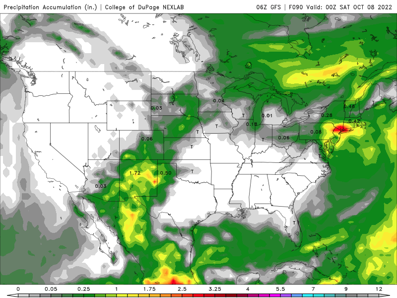
And the resulting precipitation pattern over the next week:
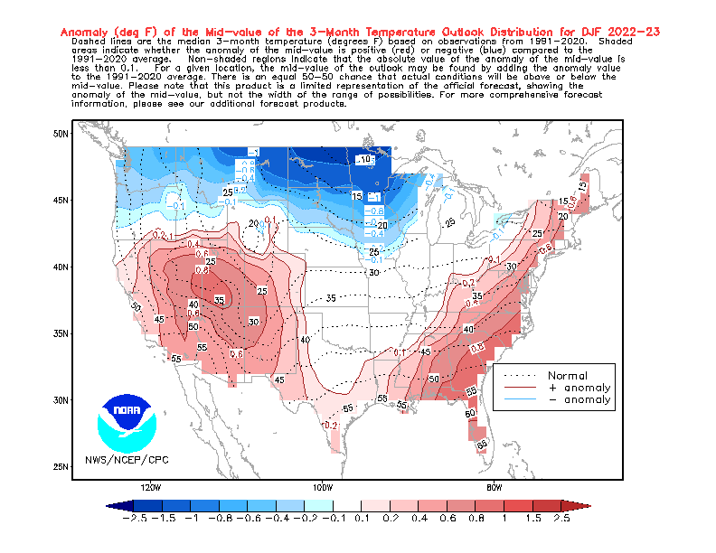
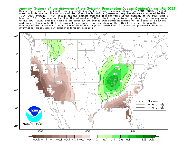
The National Weather Service concurs on our ideas about the coming winter. Here is their temperature forecast for December thru February:
And, their precipitation outlook:
Here at IQ Weather, we always look forward to the changing of the color of the leaves, which is dependent on the amount of daylight and the sun angle. Here is a map of where the leaf change is currently happening very quickly:
By November 7th, the change will spread over much of the nation:
That’s our outlook for autumn and early winter. Enjoy the next month as we watch the autumn colors progress!
STAY IN THE LOOP
Subscribe to our free newsletter.
Summer is in full swing and hot weather is on everyone’s mind. While it may seem like the huge drought and heat wave over the western United States is the worst ever, it is not. There's no doubt it is a big problem, and water levels are critical for many big cities in the southwest. […]
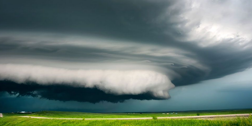
Severe weather season shows no sign of letting up early this year. Typically, as we move through June the action starts slowly shifting northward. By July and August, the higher chance for tornadoes shifts to the upper Midwest and northern Plains. But this year that northward shift may be a little slower…much like 2021. Here […]
Meteorological winter has arrived! You can always count on IQ Weather to explain the difference! You see, December 1st is the first day of meteorological winter. Typically, that is when you start seeing the colder air starting to push farther south more frequently as the daylight grows shorter. It is also a convenient way for meteorologists […]